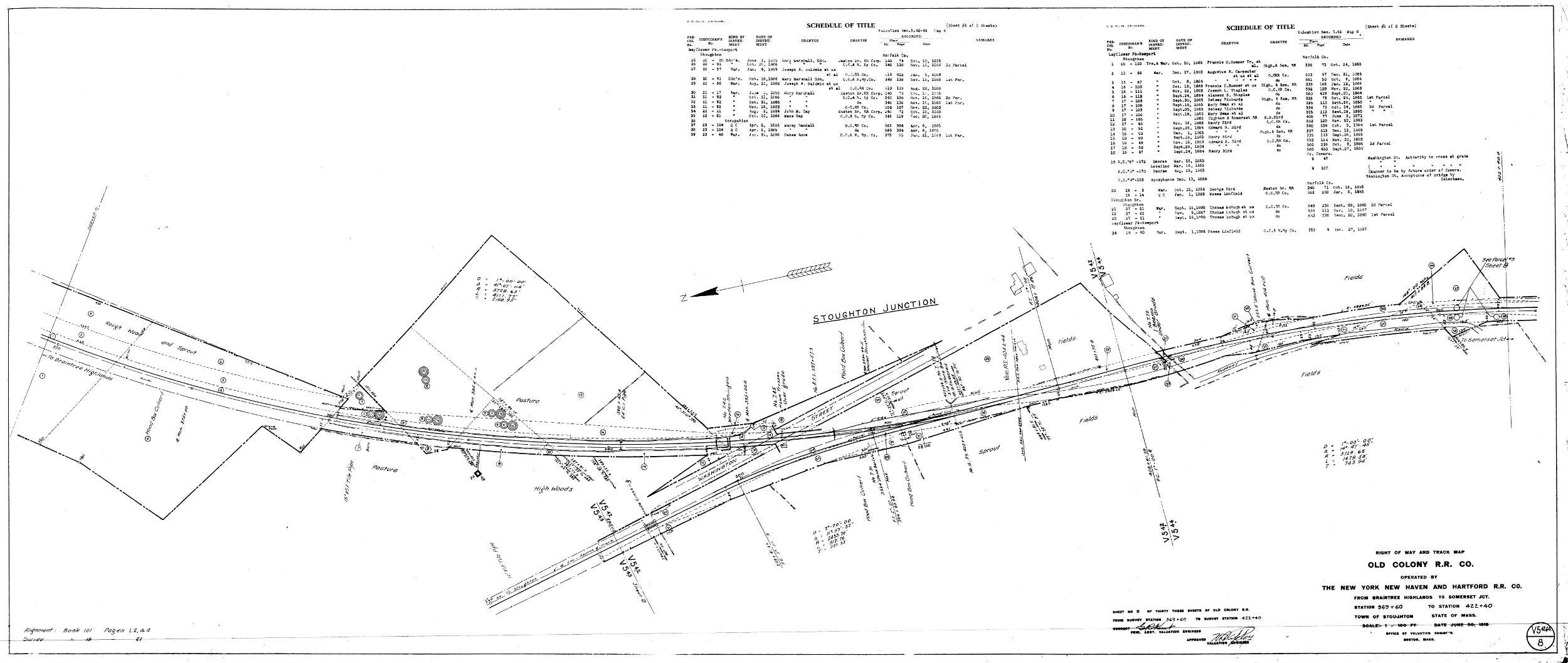
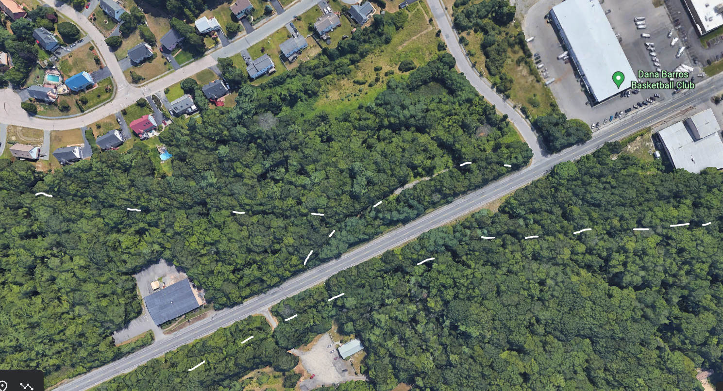
Stoughton Junction was located near the intersection of Washington Street (MA 138) and Atkinson Avenue Extension. The Old Colony Railroad line to Braintree Highlands forked off the Stoughton to Taunton line at this point. There was no station nor train stop, but there was a railroad tower on the west side of Washington Street, in front of the C.W. Welch Fish and Game.
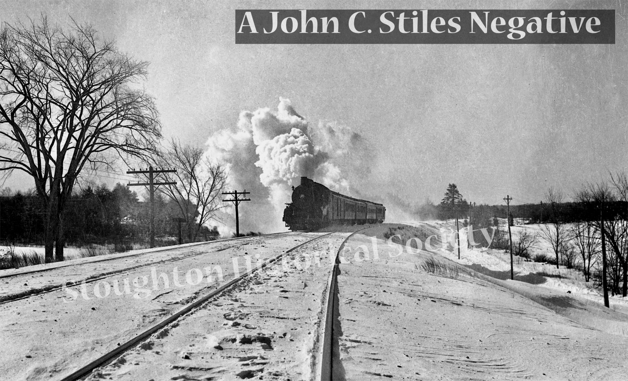
Several more photos follow. John C. Stiles' photos and negatives were scanned and prepped by John Carabatos. Clicking a photo launches an image viewer. You can navigate from image to image with the arrows, or close it by clicking the "X" in the upper right.
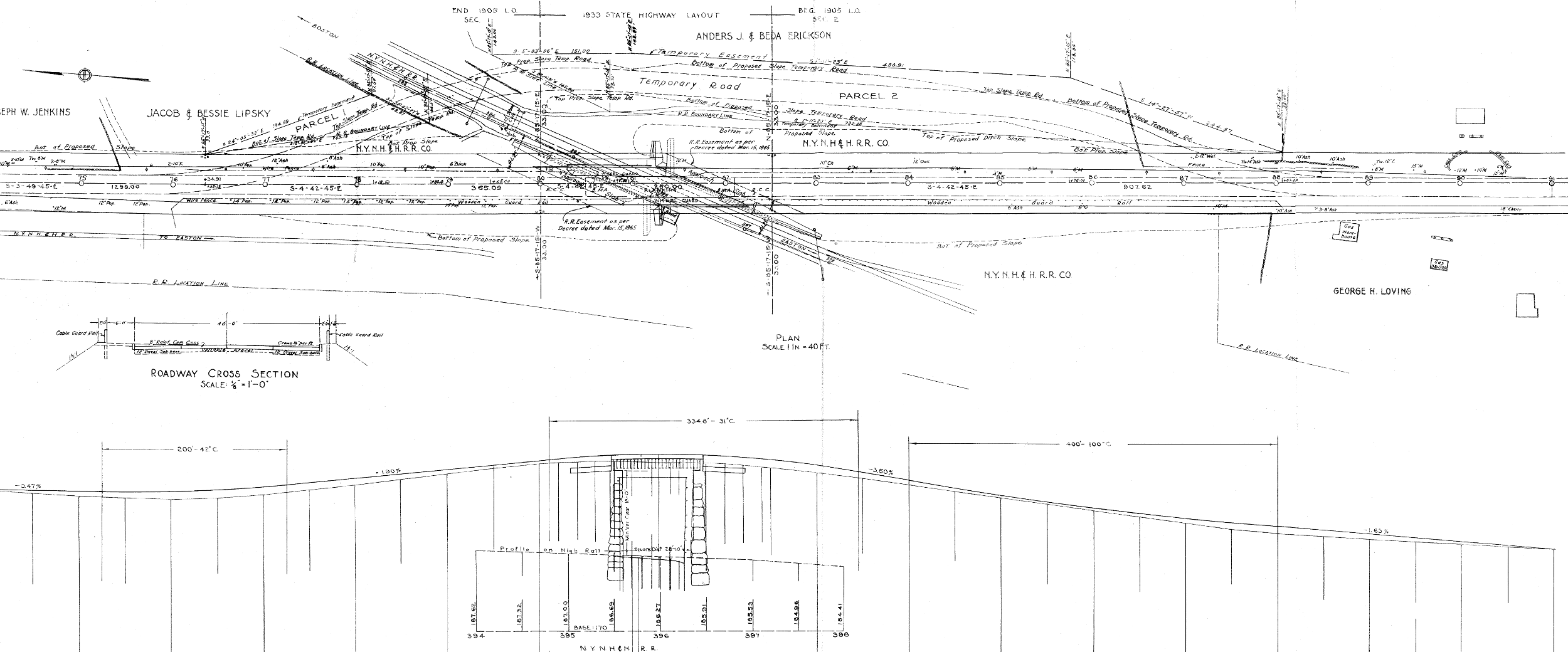
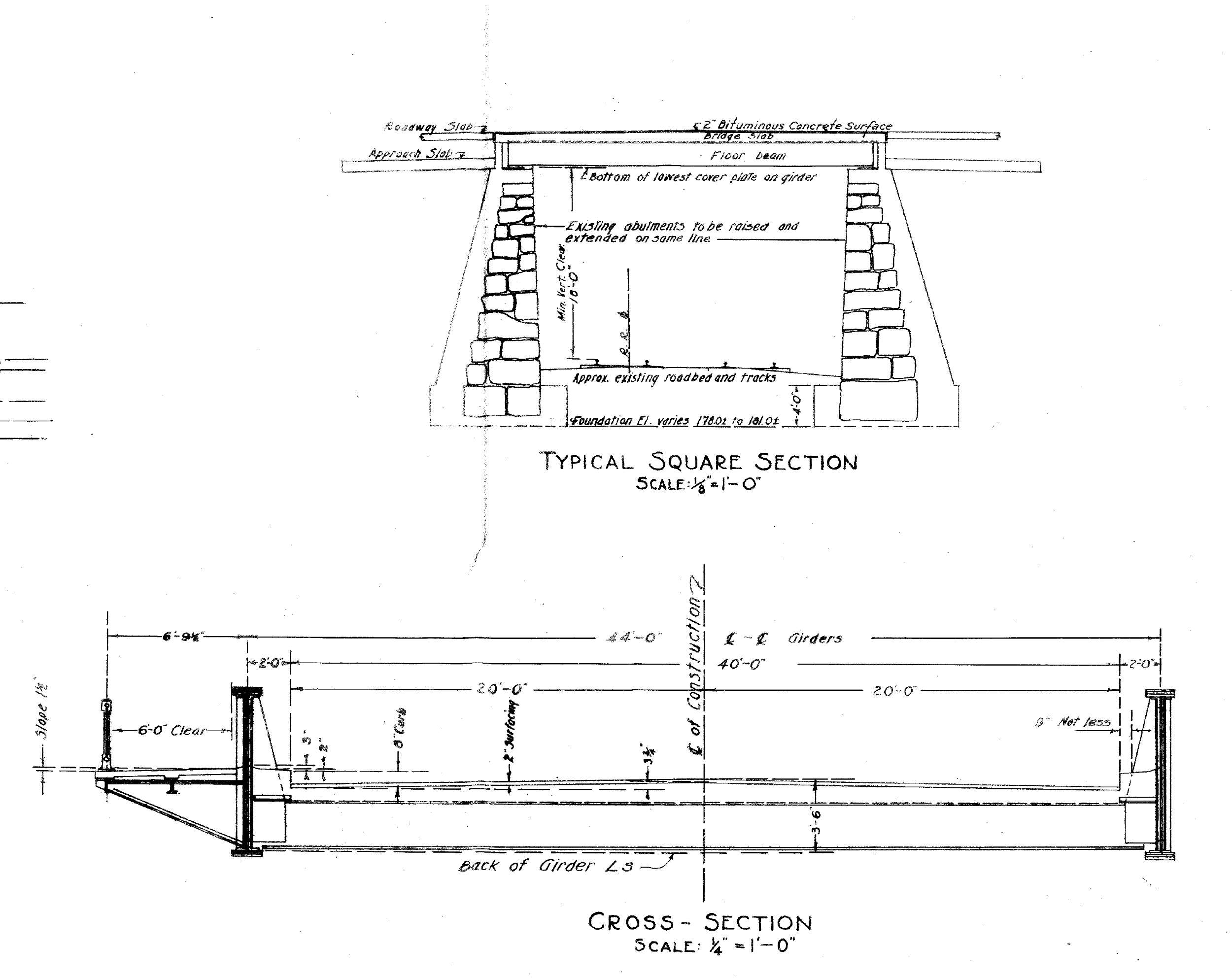
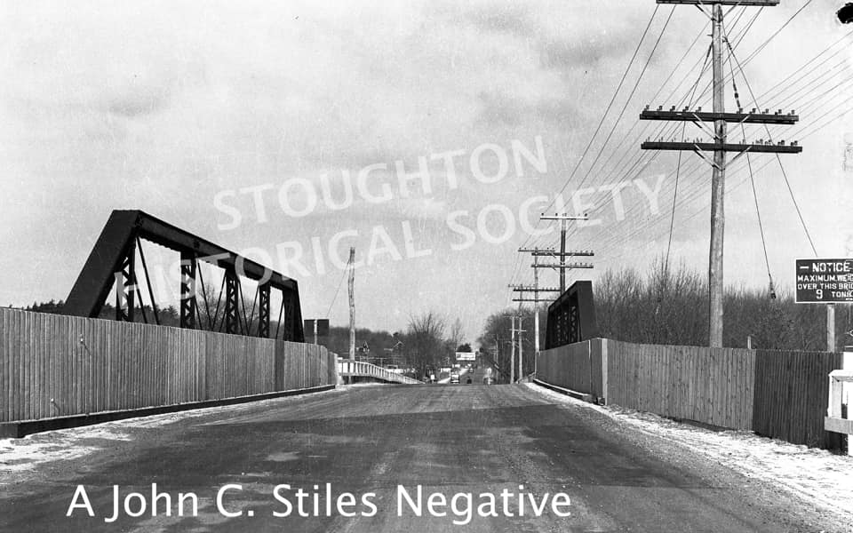
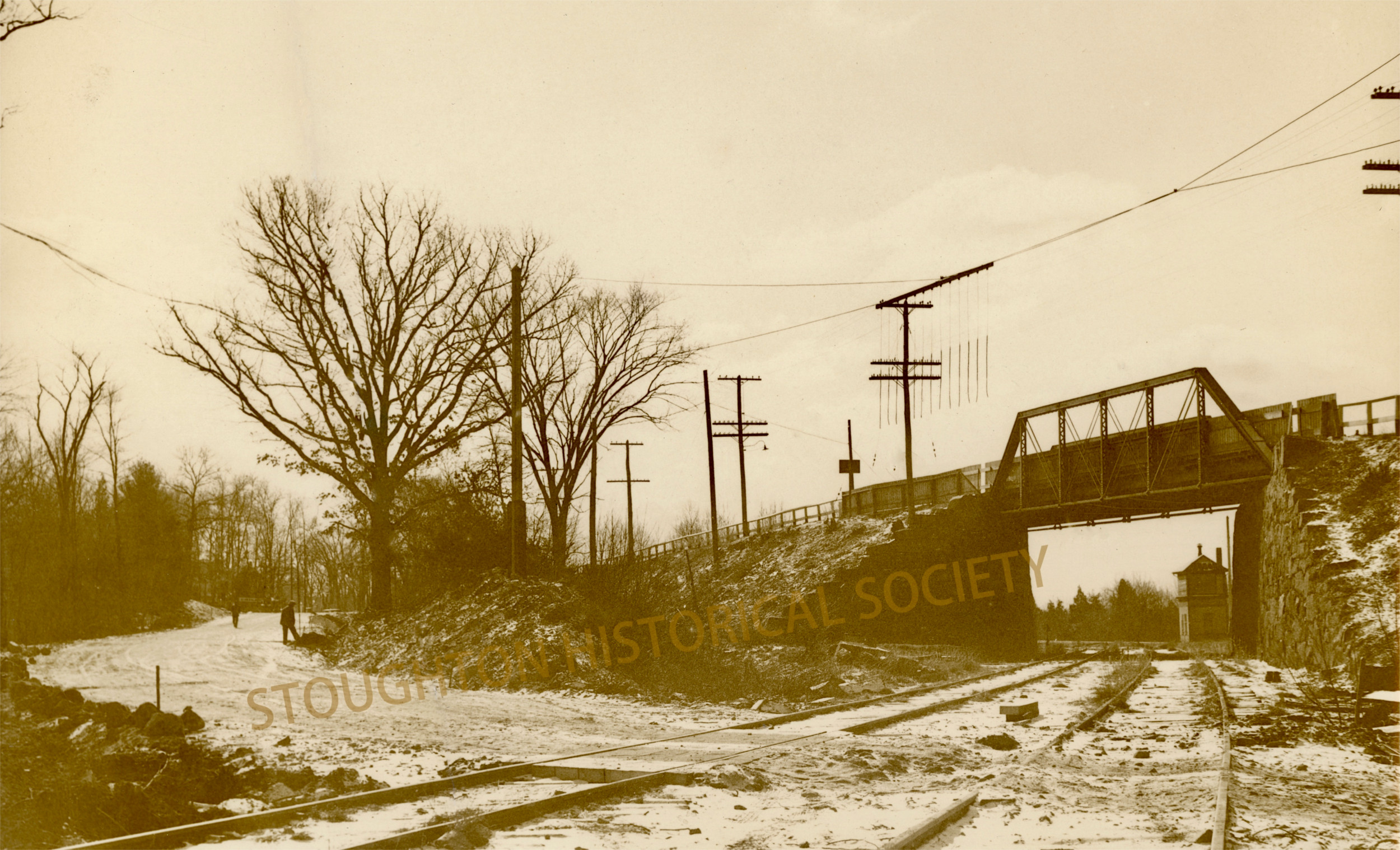
Here is the photo of the first highway bridge over the tracks. Notice it has a 9 ton weight limit, low even in 1933. This is an iron "Howe truss" bridge. Originally the tracks to Braintree Highlands, then called Mayflower Park, crossed the road at grade. Massachusetts had a push to remove at-grade crossings in the late 19th century. We believe this bridge was built in 1894, but that is not certain. As seen on the plans, the highway was re-laid out in 1905, so it could have been then. In 1933-34, along with the bridge replacement, this section of 138 was widened to 3 lanes, and surfaced with concrete. You can still feel the rhythmic bump over the old expansion joints when driving this stretch today.
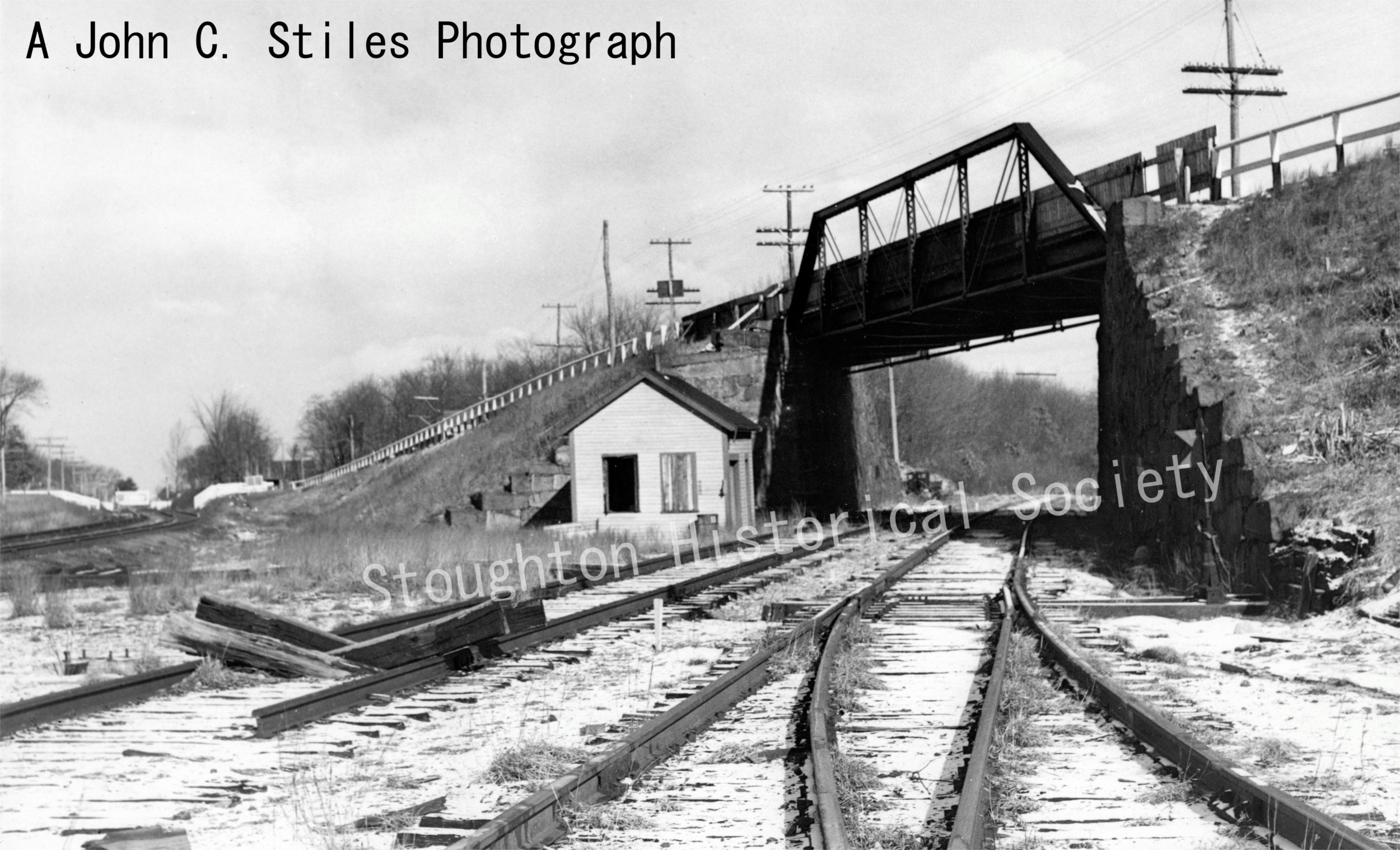
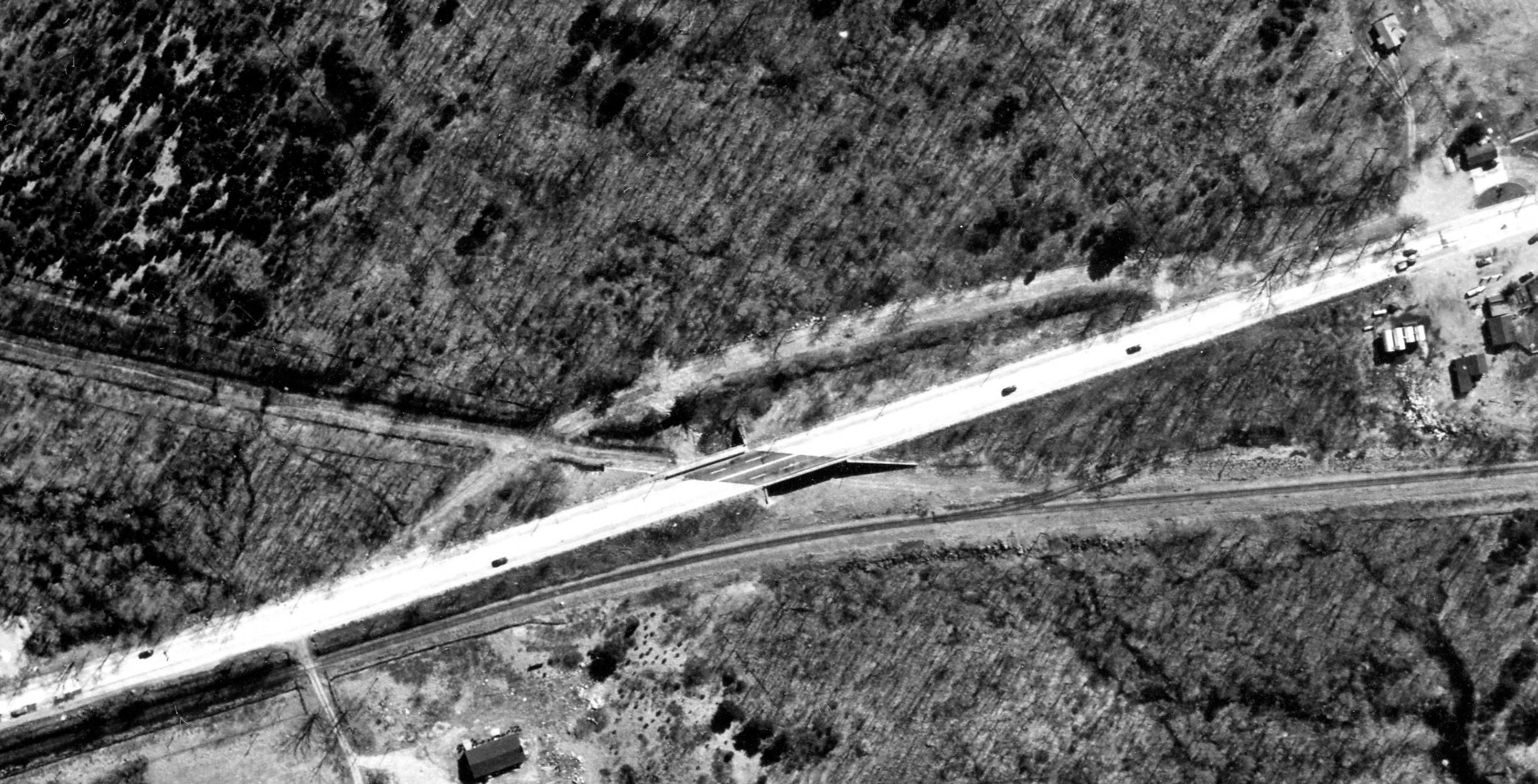
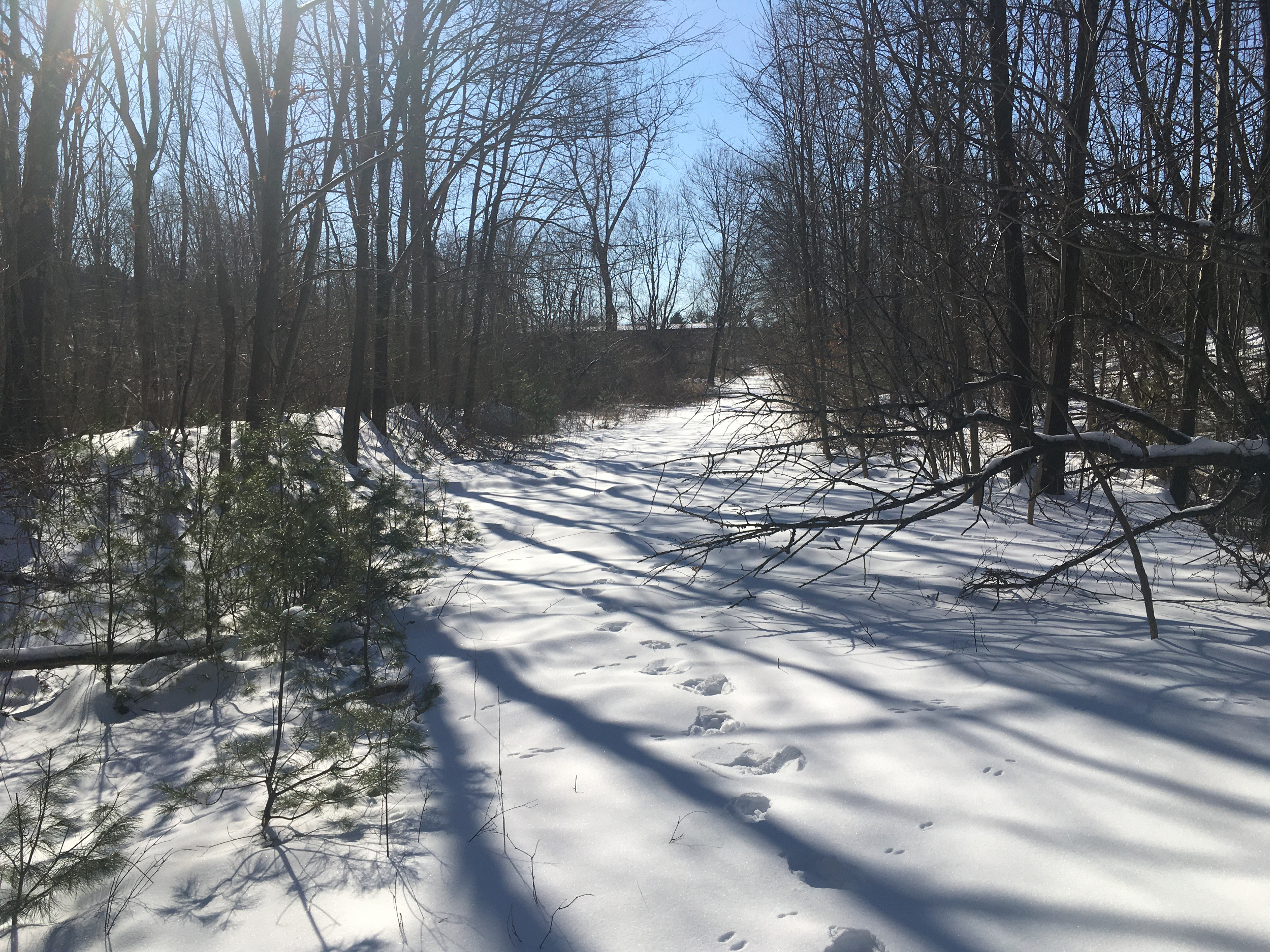
Here's an aerial view of the of the new 138 bridge over the tracks. This 1953 photo is from the society collection, digitized by John Carabatsos. In this image the tracks to Braintree have already been removed, probably to recycle the steel during WWII. This bridge never had many trains running under it. There does appear to be a small rail spur running above the main line. This may have been a loading spur for the business where Cyn Oil sits today. The temporary road is still clearly visible. We believe this temporary road was pressed back into service when the newer bridge was removed around 1960. We still have not determined the exact date.
Below is a map of the tracks at Stoughton Junction. To the east, tracks ran across Sumner, Park, Turnpike, and Central Street on their way to Braintree via Randolph. To the north the tracks run to Stoughton Center. To the south both lines merge and go to Taunton and beyond via Easton.
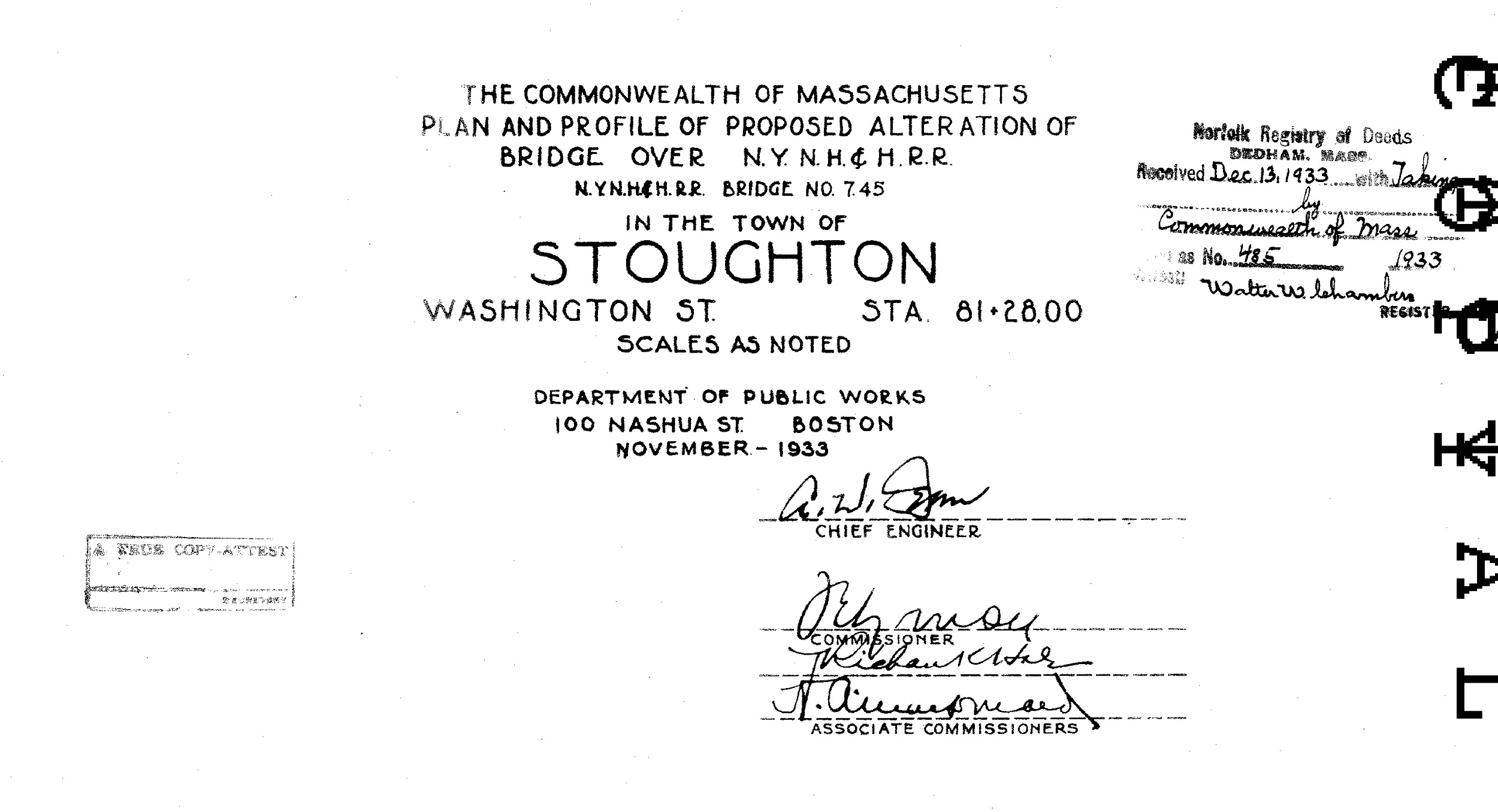
Geek alert! The author may be the only one who cares about the next images. The origins of the temporary road had mystified me since childhood. At that time (in the early 70's) we always thought it was "the old 138." We knew about the abandoned tracks, as they were much more identifiable then. There were still some rails in place in a few sections out in the woods. But I never knew about the bridge, or that the road was temporary. After becoming active in the Stoughton Historical Society, and learning of the bridge(s), I was determined to find out more about this area. Hours of deed searches later, I found these plans. Mystery solved! I hope someone else besides me enjoys this knowledge. -Dave Foley